
 10.36885/nzdpm.2026.42.12
Ключові слова: наземні молюски, Cepaea, поліморфізм, музейні колекції
Проаналізований сучасний склад та науковий потенціал колекції черепашок лісової цепеї Cepaea nemoralis і садової цепеї Cepaea hortensis, які з кінця 1990-х рр. є модельними об’єктами малакологічних досліджень у музеї. На кінець 2025 р. в основній частині малакологічного фонду музею знаходилося загалом 536 одиниць зберігання та понад 17 тис. черепашок обох видів. У часовому аспекті переважають збори початку ХХІ ст., у територіальному – вибірки зі Львова та Львівської обл. для C. hortensis, зі Львова та його найближчих околиць для C. nemoralis. У майбутньому заплановане розширення географії зборів Cepaea на заході України, а за можливості – отримання конхологічних матеріалів і з інших регіонів країни. Наразі особлива наукова цінність проаналізованої колекції полягає в тому, що в ній задокументований початковий етап стрімкого розселення C. nemoralis по урбанізованих територіях заходу України (початок ХХІ ст.), а також різні етапи інтродукції C. hortensis до того ж регіону (первинна у другій половині ХХ ст., вторинні на початку ХХІ ст.) з характерними для них фенотипічними маркерами. Зі старіших зборів (кінець ХІХ ст.) особливої уваги заслуговують дві невеликі вибірки з Ланьцута (Підкарпатське воєводство РП), які стосуються початкового етапу інтродукції C. nemoralis на південний схід Польщі. Наведено їх фенотипічний склад порівняно з даними, опублікованими на початку ХХІ ст. Серед різноманітних аномалій, пов’язаних із забарвленням і формою черепашок, у малакологічному фонді зберігається 7 сіністральних черепашок C. hortensis зі Львова, його околиць (Зубра) та Луцька. Ще одна аналогічна черепашка зі Львова буде передана до нього в поточному році. За підрахунками відомих німецьких дослідників молюсків роду Cepaea Франца Альфреда і Марії Шильдер у середньому на 45 тис. особин цього виду трапляється одна зі зміненим напрямком закручування обертів черепашки. Крім C. hortensis, у музеї є також 3 сіністральні черепашки Helix pomatia, по одній – Fruticicola fruticum, Caucasotachea vindobonensis, Helicopsis retowskii та Succinella oblonga.
Land molluscs of the genus Cepaea in the State Museum of Natural History of the NAS of Ukraine: the uniqueness of the collection and its significance for further research // Proc. of the State Nat. Hist. Mus. - Lviv, 2026. - 42. - P. 03-14.
The current composition and scientific potential of the collection of shells of the grove snail Cepaea nemoralis and the white-lipped snail Cepaea hortensis, which have been model objects for malacological research in the museum since the late 1990s, are analyzed. At the end of 2025, the main part of the museum’s malacological collection contained a total of 536 storage units and more than 17 thousand shells of these two species. In terms of time, most of the samples were collected at the beginning of the 21st century, in terms of territory, in Lviv and the Lviv region for C. hortensis, in Lviv and its immediate surroundings for C. nemoralis. In the future, it is planned to expand the geography of Cepaea collecting in western Ukraine, and, if possible, to obtain conchological material from other regions of the country. At present, the special scientific value of the analyzed collection is that it documents the initial stage of the rapid dispersal of C. nemoralis across the urbanized areas of western Ukraine (early 21st century), as well as different stages of the introduction of C. hortensis to the same region (primary introduction in the second half of the 20th century, secondary ones at the beginning of the 21st century) with their characteristic phenotypic markers. Among the older samples (late 19th century), two small samples from Łańcut (Subcarpathian Voivodeship) deserve special attention, as they relate to the initial stage of the introduction of C. nemoralis to south-eastern Poland. Their phenotypic composition is presented in comparison with data published at the beginning of the 21st century. Among the various anomalies associated with the shell colouration and shape, the malacological collection contains seven sinistral shells of C. hortensis from Lviv, its environs (Zubra) and Lutsk. Another such shell from Lviv will be transferred to it this year. According to the calculations of the renowned German researchers of molluscs of the genus Cepaea, the Schilder couple, on average, only one specimen out of 45 thousand individuals of this species has a changed direction of twisting of the shell whorls. In addition to C. hortensis, the museum also has three sinistral shells of Helix pomatia, one each of Fruticicola fruticum, Caucasotachea vindobonensis, Helicopsis retowskii and Succinella oblonga.
 10.36885/nzdpm.2026.42.02
Ключові слова: Insecta, ентомологічна колекція, оцифрування, біорізноманіття, GBIF, ДПМ НАНУ, Darwin Core, бази даних
Узагальнено дані щодо місцезнаходжень і фенотипічного складу C. nemoralis у Львові та околицях, не опубліковані або лише частково опубліковані раніше. Більшість з них було отримано в період з 2022 до 2025 р. Вперше описано знахідки цього виду у Брюховичах, Горішньому, Зимній Воді, Конопниці, Рудному, Сокільниках. Вперше наведено повний склад фенотипів, зареєстрованих поблизу великих садових центрів у Підбірцях (Клуб Рослин), Городку (Еліт Флора) і поблизу Давидова (ГалСад). У табличній формі представлено дані для 8 тис. статевозрілих особин C. nemoralis з 59 ділянок у 11 населених пунктах Львівської обл. Ще низку малих вибірок та поодиноких знахідок C. nemoralis у адміністративних межах Львова та поза ними описано в тексті. Наведені дані підтверджують швидке розселення C. nemoralis на дослідженій території. Вони також демонструють досить чіткий зв'язок багатьох новоутворених колоній з молодими декоративними насадженнями (найчастіше хвойними, а також декоративними чагарниками), що підтверджує вирішальне значення садових центрів у стрімкому розселенні цього виду. Хоча на окремих ділянках Львова та околиць фенотипічний склад C. nemoralis може бути обмеженим кількома, зрідка – навіть однією групою фенотипів (ефект засновника), загалом на дослідженій території зафіксована велика різноманітність забарвлення черепашки. Аналогічно до інших регіонів Східної Європи, найрідше у Львові та околицях трапляються особини C. nemoralis з коричневими черепашками. Крім Львова, такі екземпляри за останні роки вдалося знайти у Брюховичах, Горішньому, Городку та Підбірцях. Протягом 2019-2025 рр. у Львові та його найближчих околицях були зареєстровані майже усі можливі варіанти злиття смуг серед черепашок з 5 нормально розвиненими смугами, за винятком найрідкісніших. Порівняно з сумарними даними для видового ареалу, тут дещо рідше трапляються фенотипи (123)(45), (12345) і частіше 123(45). Отримані дані можуть бути в майбутньому використані для моніторингу як подальшого розселення C. nemoralis на Львівщині, так й можливих змін фенотипічної структури унаслідок випадкових процесів або кліматичної селекції.
The digitization of entomological collections is a key area of modern science, ensuring the long-term preservation of specimens, open access to metadata, and integration into global bioinformatics systems. This article analyzes international experience in the digital transformation of entomological collections using the examples of the Smithsonian National Museum of Natural History (USA) and the Natural History Museum, London (UK), where high-performance photography technologies, OCR, artificial intelligence, and Darwin Core standards are used for data structuring. The article examines the role of digital platforms and networks (GBIF, iDigBio, DiSSCo) in providing open access to collections for scientific, educational, and public purposes. The status of digitization of entomological collections in Ukraine is highlighted separately, in particular the activities of the State Museum of Natural History of the National Academy of Sciences of Ukraine (creation, populating the database, and maintaining the information retrieval system of the “Biodiversity of Ukraine” Data Center , digitization of the main collection of the State Museum of Natural History of the NASU, provision of scientific, methodological, and practical assistance in digitizing entomological collections of certain universities and natural history museums within the Nature Reserve Fund of Ukraine, and creation of virtual collections: taxonomic, author-based, reference, thematic, systematic, and institutional), the I. I. Shmalgauzen Institute of Zoology and university collections, including the newly established entomological collection of the V. Hnatiuk Ternopil National Pedagogical University (to date, 65 specimens of 24 species belonging to 21 genera, 15 families, and 7 orders have been digitized: Coleoptera, Dictyoptera, Hemiptera, Hymenoptera, Lepidoptera, Neuroptera, Orthoptera) . The authors emphasize that the digitization of collections contributes to the conservation of biodiversity, the advancement of scientific research, education, and the popularization of knowledge about insects. The article’s conclusions highlight the need for coordination, funding, and international integration to further advance the digitization of entomological collections in Ukraine.
 10.36885/nzdpm.2026.42.11
Ключові слова: Insecta, ентомологічна колекція, оцифрування, біорізноманіття, GBIF, ДПМ НАНУ, Darwin Core, бази даних
Оцифрування ентомологічних колекцій є ключовим напрямом сучасної науки, що забезпечує довготривале збереження зразків, відкритий доступ до метаданих і інтеграцію в глобальні біоінформаційні системи. У статті проаналізовано міжнародний досвід цифрової трансформації ентомологічних колекцій на прикладі Smithsonian National Museum of Natural History (США) та Natural History Museum, London (Велика Британія), де застосовуються високопродуктивні технології фотографування, OCR, штучний інтелект та стандарти Darwin Core для структуризації даних. Розглянуто роль цифрових платформ і мереж (GBIF, iDigBio, DiSSCo) у забезпеченні відкритого доступу до колекцій для наукових, освітніх та громадських цілей. Окремо висвітлено стан оцифрування ентомологічних колекцій в Україні, зокрема діяльність Державного природознавчого музею НАН України (створення, наповнення бази даних і ведення інформаційно-пошукової системи Центр даних «Біорізноманіття України» , оцифрування колекцій основного фонду ДПМ НАНУ, надання науково-методичної та практичної допомоги в оцифруванні ентомологічних колекцій деяких ВНЗ та музеїв природи установ природно-заповідного фонду України, створення віртуальних колекцій: таксономічних, авторських, еталонних, тематичних, систематичних, установ), Інституту зоології ім. І. І. Шмальгаузена та університетських колекцій, включно з новоствореною ентомологічною колекцією Тернопільського національного педагогічного університету імені В. Гнатюка (на сьогодні оцифровано 65 зразків 24 видів, що належать до 21 роду, 15 родин, 7 рядів: Coleoptera, Dictyoptera, Hemiptera, Hymenoptera, Lepidoptera, Neuroptera, Orthoptera). Автори підкреслюють, що цифровізація колекцій сприяє збереженню біорізноманіття, розвитку наукових досліджень, навчання та популяризації знань про комах. Висновки статті акцентують на необхідності координації, фінансування та міжнародної інтеграції для подальшого розвитку оцифрування ентомологічних колекцій в Україні.
Land molluscs of the genus Cepaea in the State Museum of Natural History of the NAS of Ukraine: the uniqueness of the collection and its significance for further research // Proc. of the State Nat. Hist. Mus. - Lviv, 2026. - 42. - P. 03-14.
The current composition and scientific potential of the collection of shells of the grove snail Cepaea nemoralis and the white-lipped snail Cepaea hortensis, which have been model objects for malacological research in the museum since the late 1990s, are analyzed. At the end of 2025, the main part of the museum’s malacological collection contained a total of 536 storage units and more than 17 thousand shells of these two species. In terms of time, most of the samples were collected at the beginning of the 21st century, in terms of territory, in Lviv and the Lviv region for C. hortensis, in Lviv and its immediate surroundings for C. nemoralis. In the future, it is planned to expand the geography of Cepaea collecting in western Ukraine, and, if possible, to obtain conchological material from other regions of the country. At present, the special scientific value of the analyzed collection is that it documents the initial stage of the rapid dispersal of C. nemoralis across the urbanized areas of western Ukraine (early 21st century), as well as different stages of the introduction of C. hortensis to the same region (primary introduction in the second half of the 20th century, secondary ones at the beginning of the 21st century) with their characteristic phenotypic markers. Among the older samples (late 19th century), two small samples from Łańcut (Subcarpathian Voivodeship) deserve special attention, as they relate to the initial stage of the introduction of C. nemoralis to south-eastern Poland. Their phenotypic composition is presented in comparison with data published at the beginning of the 21st century. Among the various anomalies associated with the shell colouration and shape, the malacological collection contains seven sinistral shells of C. hortensis from Lviv, its environs (Zubra) and Lutsk. Another such shell from Lviv will be transferred to it this year. According to the calculations of the renowned German researchers of molluscs of the genus Cepaea, the Schilder couple, on average, only one specimen out of 45 thousand individuals of this species has a changed direction of twisting of the shell whorls. In addition to C. hortensis, the museum also has three sinistral shells of Helix pomatia, one each of Fruticicola fruticum, Caucasotachea vindobonensis, Helicopsis retowskii and Succinella oblonga.
 10.36885/nzdpm.2026.42.03
Ключові слова: біорізноманіття, мурашині леви, охоронні території, сітчастокрилі, фауністика, Україна
Це дослідження представляє перший комплексний інвентаризаційний огляд Neuroptera (сітчастокрилих) національного природного парку «Кременецькі гори», природоохоронної території на північному заході Тернопільської області, Україна. Польові дослідження проводилися у 2021 та 2024 роках з використанням методів косіння ентомологічним сачком та світлових пасток у трьох репрезентативних локаціях: змішаних листяно-хвойних лісах (Гниле Озеро), вапнякових скелях із лучно-степовою рослинністю (Замкова Гора та Дівочі Скелі) та лісових узліссях біля адміністрації парку. Загалом зібрано та визначено 70 екземплярів, що представляють 16 видів з 10 родів та 3 родин. Родина Chrysopidae домінувала у фауні з 13 видами (81,3%), за нею слідували Hemerobiidae (3 види, 18,7%) та Myrmeleontidae (1 вид, 6,2%). Найчисельнішим видом виявився Chrysoperla carnea (32 екземпляри, 45,7%), за ним Nothochrysa fulviceps (7 екземплярів) та Chrysopa walkeri (6 екземплярів). Світлові пастки виявилися високоефективними, забезпечивши 88,6% усіх зібраних екземплярів. Сім видів – Chrysopa perla, C. dorsalis, Pseudomallada flavifrons, P. ventralis, Nothochrysa fulviceps, Hypochrysa elegans та Wesmaelius subnebulosus – вперше зареєстровані для Тернопільської області, разом із трьома родами (Nothochrysa, Hypochrysa, Wesmaelius). Ці доповнення розширюють регіональний список з 35 до 42 видів, що становить 39,6% фауни Neuroptera України (106 видів). Присутність двох середземноморських видів (Hypochrysa elegans та Pseudomallada flavifrons) на 50°пн.ш. свідчить або про кліматично зумовлене просування ареалів на північ, або про існування локальних мікрорефугіумів у вапнякових оселищах. Рідкісний лісовий спеціаліст Nothochrysa fulviceps підтверджує значення парку для спеціалізованих лісових таксонів. Склад фауни, домінантом якої є Chrysopidae, типовий для лісостепової зони та подібний до сусіднього природного заповідника «Медобори». Однак видове багатство (16 проти 20 видів у Медоборах) відображає попередній обсяг збору матеріалу, а не фактичні відмінності біорізноманіття. Обмежене часове охоплення (один день косіння сачком, дев’ять пасткових ночей) та відсутність весняних обстежень дозволяють припустити, що фактичне видове різноманіття може сягати 25-30 видів. Ця базова інвентаризація надає важливі дані для майбутнього моніторингу біорізноманіття та управління охороною Neuroptera на Волино-Подільській височині.
This study presents the first comprehensive inventory of Neuroptera (net-winged insects) from Kremenets Mountains National Nature Park, a protected area in northwestern Ternopil Oblast, Ukraine. Field surveys were conducted in 2021 and 2024 using sweep-netting and light trapping methods across three representative localities: mixed deciduous-coniferous forests (Hnyle Ozero), rocky limestone outcrops with meadow-steppe vegetation (Zamkova Hill and Divochi Skeli), and forest edges near the Park Administration. A total of 70 specimens representing 16 species from 10 genera and 3 families were collected and identified. Family Chrysopidae dominated the fauna with 13 species (81.3%), followed by Hemerobiidae (3 species, 18.7%) and Myrmeleontidae (1 species, 6.2%). The most abundant species was Chrysoperla carnea (32 specimens, 45.7%), followed by Nothochrysa fulviceps (7 specimens) and Chrysopa walkeri (6 specimens). Light trapping proved highly effective, yielding 88.6% of all specimens. Seven species Chrysopa perla, C. dorsalis, Pseudomallada flavifrons, P. ventralis, Nothochrysa fulviceps, Hypochrysa elegans, and Wesmaelius subnebulosus—are newly recorded for Ternopil region, along with three genera (Nothochrysa, Hypochrysa, Wesmaelius). These additions expand the regional checklist from 35 to 42 species, representing 39.6% of the Ukrainian Neuroptera fauna (106 species). The presence of two Mediterranean species (Hypochrysa elegans and Pseudomallada flavifrons) at 50°N latitude suggests either climate-driven northward range expansion or the existence of local microrefugia within limestone habitats. The rare forest specialist Nothochrysa fulviceps confirms the Park's importance for specialized woodland taxa. The fauna composition, dominated by Chrysopidae, is typical for forest-steppe zones and similar to nearby Medobory Nature Reserve. However, the lower species richness (16 vs. 20 species in Medobory) reflects preliminary sampling effort rather than actual biodiversity differences. The limited temporal coverage (one day of netting, nine trap-nights) and absence of spring surveys suggest actual species diversity may reach 25-30 species. This baseline inventory provides essential data for future biodiversity monitoring and conservation management of Neuroptera in the Volyn-Podillia Upland.
 10.36885/nzdpm.2026.42.09
Ключові слова: Megascolia maculata, Insecta, Hymenoptera, ареал, Червона книга України
Нові знахідки виду Megascolia maculata (Drury, 1773) мають важливе значення для документування сучасних процесів трансформації ареалів комах у Східній Європі та можуть розглядатися як маркер кліматично зумовлених змін біорізноманіття. У статті Г.М. Голіней зі співавторами (Голіней et al., 2023) проаналізовано поширення виду в Україні і сусідніх країнах, подано карту поширення виду та підтверджено його наявність у Тернопільській області. Автори також висловили припущення, що у наступні роки можливо очікувати знахідки сколії-гіганта у Львівській і Волинській областях, а також на території Польщі. Метою цієї роботи було уточнення поширення Megascolia maculata в Україні з урахуванням нових знахідок виду. Матеріалом слугували колекційні збори (Державний природознавчий музей Національної академії наук України, ентомологічна колекція кафедри ботаніки та зоології Тернопільського національного педагогічного університету імені Володимира Гнатюка), власні спостереження, літературні джерела, а також дані з вебресурсів з біорізноманіття: GBIF–4917 знахідок (GBIF, 2026; Megascolia…, 2026), iNaturalist – 8349 спостережень (iNaturalist, 2026), Центр даних «Біорізноманіття України» – 278 знахідок (Центр…, 2026), Національна мережа інформації з біорізноманіття – 239 знахідок (UkrBIN, 2026). Наведено дані про нові знахідки Megascolia maculata (Drury, 1773) у Рівненській та Волинській областях (16.06.2025 р., с. Нобель, Вараський р-н, Рівненська обл., 51.8670N, 25.7645E; 9.07.2025 р., с. Любешів, Камінь-Каширський р-н, Волинська обл., 51.7641N, 25.5072E). Крім того, починаючи з 2023 року вид у західному регіоні України зареєстровано також у Закарпатській, Рівненській та Хмельницькій областях. Подано карту поширення виду в регіоні та встановлено подальше розширення його ареалу в північно-західному напрямку, що, ймовірно, пов’язано як із природною експансією, так і з кліматичними змінами. Оскільки очікується подальше розширення ареалу виду у північно-західному напрямку, актуальним і важливим є моніторинг нових знахідок із прив’язкою до біотопів та з урахуванням зв’язків із господарями личинок, зокрема личинками над родини скарабеоїдних твердокрилих (Coleoptera, Scarabaeoidea). Megascolia maculata (Drury, 1773) може використосуватися як індикатор змін клімату та екосистем.
New records of the species Megascolia maculata (Drury, 1773) are of great importance for documenting current shifts in insect ranges in Eastern Europe and can be regarded as an indicator of climate-driven changes in biodiversity. The article by H.M. Holinei and co-authors (Holinei et al., 2023) analyzes the distribution of the species in Ukraine and neighboring countries, presents a distribution map of the species, confirms its presence in the Ternopil region, and suggests that in the coming years we can expect to find the Mammoth Waspin the Lviv and Volyn regions, as well as in Poland. The aim of this study was to analyze the distribution of Megascolia maculata (Drury, 1773) in Ukraine, taking into account new records of the species. The material consisted of museum collections (the State Museum of Natural History of the National Academy of Sciences of Ukraine, the entomological collection of the Department of Botany and Zoology at the Volodymyr Hnatiuk Ternopil National Pedagogical University), personal observations, literature data, and information from biodiversity websites: GBIF – 4,917 records (GBIF, 2026; Megascolia…, 2026), iNaturalist – 8,349 observations (iNaturalist, 2026), Data Centre “Biodiversity of Ukraine” – 278 records (Centre…, 2026), Ukrainian Biodiversity Information Network – 239 records (UkrBIN, 2026). This paper reports new records of Megascolia maculata (Drury, 1773) from the Rivne and Volyn regions (June 16, 2025, village of Nobel, Varash District, Rivne Region, 51.8670N, 25.7645E; July 9, 2025, Liubeshiv village, Kamin-Kashyrskyi District, Volyn Oblast, 51.7641N, 25.5072E). In addition, since 2023, the species has also been recorded in the western region of Ukraine, specifically in Zakarpattia, Rivne, and Khmelnytskyi Oblasts. A map of the species’ distribution in the region is provided, and a further expansion of the species’ range toward the northwest is confirmed which is likely due to both natural expansion and climate change. Since the species’ range is expected to continue expanding northwestward, it is both timely and important to monitor new findings in relation to their habitats and taking into account their associations with larval hosts, particularly the larvae of the Scarabaeoidea superfamily of Coleoptera. Megascolia maculata (Drury, 1773) can be used as an indicator of climate and ecosystem changes. This article was also written as part of the project 2025.07/0155 "Investigation of biodiversity, functional traits and phylogenetic structure of high-mountain meadows of the Ukrainian Carpathians in the context of habitat transformation" within the call 2025.07 "Excellent Science in Ukraine 2026-2028" is implemented with grant support from the National Research Foundation of Ukraine.
 10.36885/nzdpm.2026.42.15
Ключові слова: Collembola, біорізноманіття, деревні мікрооселища, екологічна структура, фауна, біоіндикація, охорона тварин, національний парк, раритетні види
Проведено аналіз структури та екологічних особливостей арбореального таксоцену колембол у кронах та на стовбурах осики (Populus tremula) і клена (Acer platanoides) у Вігерському національному парку (Польща). Дослідження проведено в двох висотних зонах: третій (6 – 10 метрів) та п’ятій (14 – 18 метрів). Загалом виявлено 21 вид колембол, що належать до 16 родів та 8 родин. Встановлено, що за кількістю видів переважає родина Entomobryidae (8 видів), а за показником відносної чисельності у більшості досліджених мікрооселищ домінує родина Hypogastruridae (від 49 % до 89,3 % особин). Одержані результати свідчать, що таксономічна та екологічна структура таксоценів суттєво змінюється, залежно від висоти над поверхнею землі та виду деревної рослини. Проаналізовано основні індекси різноманіття для таксоцену колембол у досліджених висотних зонах осики та клена. Виявлено тенденцію до збільшення видового багатства та складності екологічної структури таксоцену колембол із зростанням висоти, що ймовірно пов’язано зі збільшенням гетерогенності екологічних умов у цьому висотному напрямі. Розрахунок індексів показав, що індекс Шеннона (H') збільшується із 1,3 у нижній частині стовбура до 1,8 у кроні, а індекс Маргалефа відповідно з 1,4 до 3,1. При цьому індекс домінування Бергера-Паркера зменшується відповідно з 0,4 до 0,3, що вказує на більш рівномірний розподіл видів колембол за чисельністю у верхньому ярусі. Порівняльний аналіз показав, що видове багатство таксоцену колембол на клені є значно меншим, ніж на осиці. На клені зафіксовано меншу, порівняно з осикою, вирівняність населення колембол та абсолютне домінування Xenylla szeptyckii. Встановлено, що у кронах досліджених видів дерев домінують ксерорезистентні кортицикольні види. Виявлено 10 раритетних видів (Xenylla boerneri, Xenylla szeptyckii, Xenylla maritima, Pratanurida boerneri, Anurophorus laricis, Orchesella bifasciata, Entomobrya nivalis, Entomobrya corticalis, Willowsia nigromaculata, Sminthurinus lawrencei), відносна чисельність яких складає 85,7 % дослідженого таксоцену, що свідчить про високу природоохоронну цінність арбореальної фауни колембол Вігерського національного парку.
An analysis was conducted of the structure and ecological characteristics of the arboreal Collembola taxocenosis in the crowns and on the trunks of aspen (Populus tremula) and maple (Acer platanoides) in Wigersky National Park (Poland). The study was conducted in two height zones: the third (6–10 metres) and the fifth (14–18 metres). A total of 21 springtail species belonging to 16 genera and 8 families were identified. It was established that the family Entomobryidae predominates in terms of species richness (8 species), whilst the family Hypogastruridae dominates in terms of relative abundance in most of the microhabitats studied (ranging from 49% to 89.3% of individuals). The results indicate that the taxonomic and ecological structure of the taxocenoses varies significantly depending on the height above ground level and the species of tree. The main diversity indices for the collembola taxocenosis in the studied altitudinal zones of aspen and maple were analysed. A trend towards an increase in species richness and the complexity of the ecological structure of the collembola taxocenosis with increasing height was identified, which is likely associated with an increase in the heterogeneity of ecological conditions in this altitudinal direction. Calculation of the indices showed that the Shannon index (H') increases from 1.3 at the base of the trunk to 1.8 in the crown, and the Margalef index from 1.4 to 3.1, respectively. At the same time, the Berger-Parker dominance index decreases from 0.4 to 0.3, indicating a more even distribution of collembolan species by abundance in the upper canopy. A comparative analysis showed that the species richness of the collembola community on maple is significantly lower than on aspen. On maple, the evenness of the springtail population was found to be lower than on aspen, and Xenylla szeptyckii was found to be absolutely dominant. It was established that xeroresistant corticolous species dominate in the crowns of the studied tree species. Ten rare species were identified (Xenylla boerneri, Xenylla szeptyckii, Xenylla maritima, Pratanurida boerneri, Anurophorus laricis, Orchesella bifasciata, Entomobrya nivalis, Entomobrya corticalis, Willowsia nigromaculata, Sminthurinus lawrencei), whose relative abundance accounts for 85.7% of the studied taxocenosis, indicating the high conservation value of the arboreal collembola fauna of the Vigersky National Park.
 10.36885/nzdpm.2026.42.08
Ключові слова: кліщі орібатиди, старовікові ліси, деревні мікрооселища, первинний ґрунт (мікроґрунт) на стовбурі дерева, Fagus sylvatica
В статті розглянуто таксономічне та екологічне різноманіття угруповань панцирних кліщів (Oribatida), що населяють первинний ґрунт на стовбурі дерева Fagus sylvatica у старовікових лісах національного природного парку «Бойківщина». Особливу увагу приділено цьому специфічному мікробіотопу як унікальному середовищу існування, яке поєднує властивості наземних ґрунтів і епіфітних субстратів. У дослідженому мікробіотопі виявлено 20 видів орібатид, які належать до 18 родів та 16 родин. Найбільшу частку у структурі угруповання становлять представники родин Oppiidae та Oribatellidae. Серед родів домінують Oribatella та Oppiella. До групи домінантів належать Oppiella nova, Oribatella calcarata та Oribatella quadricornuta. Субдомінантна група представлена видами Dissorhina ornata, Kulievia paradecipiens, Metabelba pulverulenta, Steganacarus spinosus, Chamobates spinosus та Chamobates borealis. Значна частка видів характеризується низькою чисельністю і належить до групи рецедентів. Відмічаємо види Dissorhina ornata та Chamobates borealis, що притаманні для букових лісів та зони високогір’я. А також види: Minunthozetes pseudofusiger, Chamobates spinosus, Metabelba pulverulent пов’язують з стовбурами дерев. Екологічний аналіз показав, що більшість виявлених видів належать до лісової біотопної групи, а на другому місті евритопна фауна, тоді як у структурі гігропреференцій домінують еврибіонти. Помітну частку становлять також гігрофільні види, що свідчить про достатній рівень зволоження дослідженого мікрооселища. Структура домінування орібатидних угруповань первинного ґрунту (мікроґрунту) на стовбурі дерева розподілилася майже рівним відсотковим співвідношенням серед трьох показників домінування: домінанти, субдомінанти та рецеденти. Отримані результати підтверджують, що первинний ґрунт на стовбурах дерев є важливим, складним і водночас недостатньо дослідженим мікробіотопом, який забезпечує існування значного різноманіття орібатидних кліщів. Це підкреслює його суттєве значення у підтриманні біорізноманіття ґрунтової мікрофауни старовікових букових лісів Українських Карпат та актуальність подальших досліджень цього унікального компоненту лісових екосистем.
The article examines the taxonomic and ecological diversity of oribatid mite (Oribatida) communities inhabiting the primary soil formed on the trunk of Fagus sylvatica in old-growth forests of the National Nature Park “Boikivshchyna”. Special attention is paid to this specific microhabitat as a unique environment that combines the properties of terrestrial soils and epiphytic substrates. In the studied microhabitat, 20 species of oribatid mites belonging to 18 genera and 16 families were identified. The largest share in the community structure is represented by the families Oppiidae and Oribatellidae. Among the genera, Oribatella and Oppiella dominate. The dominant group includes Oppiella nova, Oribatella calcarata, and Oribatella quadricornuta. The subdominant group is represented by Dissorhina ornata, Kulievia paradecipiens, Metabelba pulverulenta, Steganacarus spinosus, Chamobates spinosus, and Chamobates borealis. A significant proportion of species is characterized by low abundance and belongs to the group of recedents. Particular attention should be given to Dissorhina ornata and Chamobates borealis, which are typical of beech forests and high-mountain zones. In addition, species such as Minunthozetes pseudofusiger, Chamobates spinosus, and Metabelba pulverulenta are associated with tree trunks. The ecological analysis showed that most of the identified species belong to the forest biotopic group, while eurytopic fauna occupies the second position. In terms of hygrophilous preferences, eurybionts dominate. A noticeable proportion is also represented by hygrophilous species, indicating a sufficientlevel of moisture in the studied microhabitat. The dominance structure of oribatid communities in the primary soil (microsoil) on tree trunks is characterized by an almost equal percentage distribution among three groups: dominants, subdominants, and recedents. The obtained results confirm that primary soil on tree trunks is an important, complex, and still insufficiently studied microhabitat that supports a considerable diversity of oribatid mites. This highlights its significant role in maintaining the biodiversity of soil microfauna in old-growth beech forests of the Ukrainian Carpathians and underscores the need for further research on this unique component of forest ecosystems.
 10.36885/nzdpm.2026.42.01
Ключові слова: полоз лісовий, історія дослідження, знахідки, Тернопілля, стан популяцій, проблеми збереження
На основі аналізу літературних джерел відтворено історію дослідження в регіоні Середнього Дністра (придністрянські райони Тернопільської, Чернівецької та Івано-Франківської областей) одного з найрідкісніших видів змій фауни України – полоза лісового (Zamenis longissimus). До недавнього часу навіть саме питання існування цього виду в регіоні викликало суперечливі трактування. Достовірні знахідки полоза лісового в межах регіону відомі від початку ХХ ст. Час від часу вид надовго зникав з поля зору зоологів. Регулярні виявлення полоза лісового на досліджуваній території розпочалися у другому десятилітті ХХІ ст. Переважна частка трапляння цього виду припадає на лівобережжя Дністра в межах Тернопільської області, зокрема на територію Національного природного парку «Дністровський каньйон». Численні випадки виявлення полоза, підтверджені фото- та відеоматеріалами, починаючи від 2012 року, засвідчують існування в Дністровському каньйоні доволі чисельної та стабільної популяції полоза лісового. Сприятливим чинником позитивної динаміки популяції цього дендрофільного виду стало масштабне поширення деревно-чагарникової рослинності в регіоні, зумовлене згортанням господарської діяльності в долинах Дністра та його приток, зокрема різким зменшенням випасання худоби, заготівлі сіна, розорювання. Сучасні знахідки полоза лісового приурочені до долини р. Дністер та його приток на відтинку між гирлом р. Серет на півдні та гирлом р. Бариш на півночі. Виділено три райони, де вид трапляється найчастіше: долина Дністра на відтинку від с. Добрівляни до с. Городок; долина р. Джурин від гирла в с. Устечко до с. Нирків; а також долина Дністра нижче гирла р. Стрипа до с. Хмелева. Відсутність знахідок з інших ділянок Дністра, імовірно, зумовлена браком інформації, а не реальною відсутністю виду. Серед чинників, що негативно впливають на стан популяції, провідну роль відіграє антропогенний вплив. Зокрема, у 7,14% проаналізованих випадків виявлено загибель особин під колесами автотранспорту; така ж частка припадає на навмисне знищення полозів місцевими жителями, зумовлене поширеним негативним ставленням до змій.
Based on an analysis of literature sources, the history of research on one of the rarest snake species in the fauna of Ukraine – the Aesculapian snake (Zamenis longissimus) – in the Middle Dniester region (the Dniester valley parts of Ternopil, Chernivtsi, and Ivano-Frankivsk Regions) has been reconstructed. Until recently, even the very existence of this species in the region was subject to contradictory interpretations. Reliable records of the Aesculapian snake within the study area have been known since the early twentieth century. From time to time, the species disappeared from the view of zoologists for long periods. Regular records of Z. longissimus in the region began in the second decade of the twenty-first century. The vast majority of records of this species are known from the left bank of the Dniester River within Ternopil Region, particularly within the territory of the Dniester Canyon National Nature Park. Numerous records of the species, confirmed by photo and video materials since 2012, indicate the existence of a relatively abundant and stable population of the Aesculapian snake within the Dniester Canyon. A favorable factor contributing to the positive population trend of this dendrophilous species has been the large-scale expansion of tree and shrub vegetation in the region, caused by the decline of economic activities in the valleys of the Dniester River and its tributaries, including a sharp reduction in grazing, haymaking, and plowing. Recent records of the Aesculapian snake are confined to the valley of the Dniester River and its tributaries between the mouth of the Seret River in the south and the mouth of the Barysh River in the north. Three areas with the highest frequency of records can be distinguished: the Dniester River valley from the village of Dobrivliany to Horodok; the Dzhuryn River valley from its mouth near the village of Ustechko to Nyrkiv; and the Dniester River valley downstream from the mouth of the Strypa River to the village of Khmeleva. The absence of records from other sections of the Dniester River most likely reflects a lack of information rather than the actual absence of the species. Among the factors negatively affecting the population status, anthropogenic impact plays a leading role. In particular, in 7.14% of the analyzed cases, mortality caused by road traffic was recorded; an equal proportion corresponds to deliberate killing of snakes by local residents, driven by a generally negative attitude toward snakes.
 10.36885/nzdpm.2026.42.04
Ключові слова: річка Куделя, заплава, раритетні види, заказник, риби, птахи
Гідрологічний заказник річка Куделя входить до басейну річки Ірпінь. Дослідження проводили на 8 станціях. Проведено інвентаризацію фауни тварин, локалізованих у водних та водно-болотних біоценозах. Встановлено, що у межах заказника представлені 24 види риб, 6 видів амфібій, 2 види рептилій, 36 видів водно-болотних птахів, 4 види амфібіонтних ссавців. Найбільше видове багатство риб зосереджено у пониззі р. Куделя, на русловому ставку та верхів’ї Куделі в межах кар’єру (17-20 видів). Найбільша частота трапляння зафіксована для наступних видів: Leucaspius delineatus, Carassius auratus, Perca fluviatilis, Rutilus rutilus, Scardinius erythrophthalmus Esox lucius, Perccottus glenii (62,5-100%). Серед видів, що входять до Директиви ЄС про Смарагдову мережу зареєстровано: 2 види риб (Rhodeus amarus, Cobitis taenia), 1 вид амфібій (Bombina bombina), 1 вид рептилій (Emys orbicularis), 16 видів птахів та 1 вид ссавців (Castor fiber). За результатами досліджень зареєстровано 14 видів тварин, що занесені до Червоної книги України: 3 види водних безхребетних (Anodonta cygnea, Hirudo medicinalis, Anax imperator), 1 вид риб (Leuciscus leuciscus), 10 видів птахів (Haliaeetus albicilla, Circaetu gallicus, Clanga clanga, Clanga pomarina, Milvus migrans, Grus grus, Columba oenas, Lanius excubitor, Circus pygargus, Circus cyaneus). Зазначені види використовують територію заказника переважно під час сезонних та кормових міграцій. Lanius excubitor – для зимівлі, Сircus pygargus та Grus grus ймовірно гніздові види. Окрім власне території заказника, значний природоохоронний інтерес мають прилеглі до нього природні угіддя, зокрема гирло Куделі, верхів’я Куделі із заболоченим руслом річки та кар’єрним ставком, а також деякі фрагменти Куделі у межах чорновільхових лісів. Результати досліджень підтверджують вагому роль гідрологічного заказника "Річка Куделя" та прилеглих територій у збереженні локального біорізноманіття та можуть бути використані при обґрунтуванні оптимального режиму збереження заплавних біотопів та застосуванні активного менеджменту з метою оптимізації стану та відновлення малих річок Полісся.
The Kudelya River hydrological reserve is part of the Irpen River basin. The study was conducted at eight stations. An inventory of animal fauna localized in aquatic and wetland biocenoses was conducted. It was established that 24 fish species, 6 amphibian species, 2 reptile species, 36 waterbird species, and 4 amphibian mammal species are present within the reserve. The greatest diversity of fish species is concentrated in the lower reaches of the Kudelya River, in the channel pond and the upper reaches of the Kudelya within the quarry (17-20 species). The highest frequency of occurrence was recorded for the following species: Leucaspius delineatus, Carassius auratus, Perca fluviatilis, Rutilus rutilus, Scardinius erythrophthalmus Esox lucius, Perccottus glenii (62.5-100%). Among the species included in the EU Emerald Network Directive, the following have been registered: 2 fish species (Rhodeus amarus, Cobitis taenia), 1 amphibian species (Bombina bombina), 1 reptile species (Emys orbicularis), 16 bird species, and 1 mammal species. Based on the research results, 14 animal species listed in the Red Data Book of Ukraine have been registered: 3 aquatic invertebrate species (Anodonta cygnea, Hirudo medicinalis, Anax imperator), 1 fish species (Leuciscus leuciscus), and 10 bird species (Haliaeetus albicilla, Circaetu gallicus, Clanga clanga, Clanga pomarina, Milvus migrans, Grus grus, Columba oenas, Lanius excubitor, Circus pygargus, Circus cyaneus). These species use the reserve’s territory primarily during seasonal and feeding migrations. Lanius excubitor is a wintering ground, while Circus pygargus and Grus grus are likely nesting species. In addition to the reserve itself, the adjacent natural areas are of significant conservation interest, including the Kudelya River mouth, the upper reaches of the Kudelya with its swampy riverbed and quarry pond, and some sections of the Kudelya within black alder forests. The research results confirm the significant role of the Kudelya River hydrological reserve and adjacent areas in preserving local biodiversity and can be used to justify optimal conservation regimes for floodplain biotopes and the application of active management to optimize the condition and restore small rivers in Polissya.
 10.36885/nzdpm.2026.42.07
Ключові слова: Cetraria islandica, охорона біорізноманіття, високогір’я, Українські Карпати
Cetraria islandica L. в Україні трапляється передусім у Карпатах, спорадично на Поліссі, а в південних областях країни є рідкісним видом. У 2014 році Комітет Європейського Союзу з лікарських засобів рослинного походження класифікував C. islandica як традиційний лікарський засіб. В останні десятиріччя спостерігається зменшення чисельності популяцій C. islandica внаслідок надмірної заготівлі. Вид є загроженим також внаслідок забруднення повітря і руйнування оселищ. У високогір’ї Карпат винищення цього лишайника відбувається зокрема на заповідних територіях. Це призводить до порушення структури рідкісних угруповань, що перебувають під охороною (Зелена книга України), їхньої дигресії і ураження численних популяцій ендемічних і рідкісних видів Червоної книги України. C. іslandica є типовим асектатором більшості альпійських і привершинних субальпійських первинних фітоценозів у діапазоні висот 1700-2000 м н.р.м. Проективне покриття цього виду становить здебільшого 5-15%. В окремих угрупованнях, зокрема лохинниках і рододендронниках, покриття сягає 25%, де цетрарія ісландська набуває позиції субдомінанта. C. islandica відіграє роль протектора для усіх видів фітоценозів альпійського поясу за екстремальних умов – низьких температур й інтенсивних вітрів. У результаті порушення лишайникового покриву відбувається заміна первинних альпійських фітоценозів вторинними тривалопохідними. Очевидно, демутаційне відновлення структури угруповань після припинення вилучення C. islandica буде тривати десятиліттями. До таких дигресивних змін призведуть навіть одноразові інтенсивні заготівлі, адже швидкість відростання особин цього лишайника особливо повільна. На ділянках видалення покриву C. islandica процеси відновлення рослинності сповільнюються внаслідок вітрової і водної ерозії, а також кліматогенних змін. За збереження сучасних тенденцій заготівлі, масштабна деградація альпійської рослинності Українських Карпат і численних фітоценозів Полісся є неминучою. Відтак, заборона заготівлі та надання на території України C. islandica статусу охорони шляхом занесення виду до Червоної книги України є актуальними.
Cetraria islandica L. in Ukraine is primarily found in the Carpathians, sporadically in Polissya, and is rare in the country's southern regions. In 2014, the European Union Committee for Herbal Medicinal Products classified C. islandica as a traditionally used herbal medicinal product. In recent decades, there has been a decline in the number of C. islandica populations due to overharvesting. The species is also threatened by air pollution and habitat destruction. In the highlands of the Carpathians, the depletion of this lichen occurs, in particular, even within protected areas. This leads to disruption of the structure of rare plant communities listed in the Green Book of Ukraine, their degradation, and the decline of numerous populations of endemic and rare species included in the Red Book of Ukraine. C. islandica is a typical component of most alpine and upper subalpine primary phytocoenoses within the altitude range of 1700–2000 m a.s.l. The projective cover of this species is usually 5–15%. In some communities, particularly those dominated by blueberry and rhododendron, where C. islandica is a subdominant with projective coverage up to 25%. C. islandica plays an important protective role in alpine phytocoenoses under extreme environmental conditions, such as low temperatures and strong winds. As a result of the loss of lichen cover, primary alpine phytocoenoses are replaced by long-term secondary communities. The natural recovery (demutation) of community structure after the cessation of C. islandica harvesting may take decades. Even a single episode of intensive harvesting can cause significant degradation, as the growth rate of this lichen is particularly slow. In areas where C. islandica cover has been removed, vegetation recovery is further slowed by wind and water erosion, as well as climate-related factors. If current harvesting trends continue, large-scale degradation of alpine vegetation in the Ukrainian Carpathians and many phytocoenoses in Polissya is unavoidable. Therefore, a ban on harvesting and the granting of protected status to C. islandica in Ukraine—through its inclusion in the Red Book of Ukraine—are necessary and justified.
 10.36885/nzdpm.2026.42.17
Ключові слова: сукцесійні зміни, субальпійська рослинність, дигресивна трансформація, демутаційна сукцесія, сукцесійні системи, моніторинг, заповідання
Проаналізовано 50-річні дослідження субальпійської рослинності Українських Карпат, які виявили низку універсальних закономірностей сукцесійних змін під впливом антропогенних чинників і без втручання людини, у тому числі поступове зникнення антропогенної верхньої межі лісу та формування нової, але вже кліматичної верхньої межі лісу, яка внаслідок синергічного впливу демутаційних і кліматогенних чинників посилює тенденцію до зміщення на вищі гіпсометричні рівні за рахунок субальпійського поясу, де на його нижній границі на заповідних територіях вже зараз відбувається відчутна трансформація субальпійських трав’яних угруповань через експансію чагарникових угруповань, в першу чергу за домінуванням Juniperus sibirica Burgsd. Вторинні сукцесійні трансформаційні процеси в рослинному покриві субальпійського поясу карпатського високогір’я мають циклічний характер і повторюються в часі. Вони відбуваються у формі елементарних сукцесійних систем, сукупності яких утворюють сукцесійні комплекси корінних асоціацій. Головними екзогенними чинниками сукцесійних змін субальпійської рослинності карпатського високогір’я були і надалі залишаються демутаційні і кліматогенні процеси, які мають синергічний ефект. Не зважаючи на значні дигресивні зміни субальпійської рослинності високогір’я, які спричиняються антропогенними чинниками, похідні угруповання довго зберігають ознаки корінних, і в разі запровадження заповідного режиму відбувається активація демутаційних сукцесійних процесів в рослинному покриві, що спричиняє автогенне відновлення первинних типів фітоценозів на територіях, зайнятими вторинними лучними, чагарничковими та чагарниковими угрупованнями. Дослідження динаміки рослинного покриву із застосуванням методу популяційно-фітоценотичного системного аналізу дозволяє більш ефективно й систематизовано встановлювати напрями і швидкість змін рослинних угруповань після встановлення заповідного режиму на ділянках з порушеною рослинністю, що сприяє вирішенню проблем збереження існуючого та відновлення втраченого фіторізноманіття і відкриває перспективи управління цими процесами у високогір’ї Українських Карпат.
50-year studies of the subalpine vegetation of the Ukrainian Carpathians were analyzed, which revealed a number of universal patterns of successional changes under the influence of anthropogenic factors and without human intervention, including the gradual disappearance of the anthropogenic upper forest boundary and the formation of a new, but already climatic upper forest boundary, which, due to the synergistic influence of demutation and climatogenic factors, enhances the tendency to shift to higher hypsometric levels at the expense of the subalpine belt, where at its lower border in protected areas a noticeable transformation of subalpine herbaceous communities is already taking place due to the expansion of shrub communities, primarily dominated by Juniperus sibirica Burgsd. Secondary successional transformation processes in the vegetation cover of the subalpine belt of the Carpathian highlands are cyclical in nature and repeat over time. They occur in the form of elementary successional systems, the aggregates of which form successional complexes of root associations. The main exogenous factors of successional changes in the subalpine vegetation of the Carpathian highlands were and continue to be demutational and climatogenic processes, which have a synergistic effect. Despite the significant digressive changes in the subalpine vegetation of the highlands, which are caused by anthropogenic factors, the derived groups retain the signs of the root ones for a long time, and in the case of the introduction of a reserve regime, demutational successional processes are activated in the plant cover, which causes autogenic restoration of primary types of phyto cоenoses in the territories occupied by secondary meadow, shrub and shrub groups. The study of vegetation dynamics using the method of population-phytocoenotic system analysis allows for a more effective and systematic determination of the directions and rate of changes in plant communities after the establishment of a protected area regime in areas with disturbed vegetation, which contributes to solving the problems of preserving existing and restoring lost phytodiversity and opens up prospects for managing these processes in the highlands of the Ukrainian Carpathians.
 10.36885/nzdpm.2026.42.05
Ключові слова: водна рослинність, Phragmition australis, синтаксономія, НПП «Пирятинський», фітоценози
Проаналізовано рослинність союзу Phragmition australis Koch 1926 (клас Phragmiti-Magno-Caricetea Klika in Klika et Novak 1941) на території Національного природного парку «Пирятинський». Встановлено, що союз Phragmition australis на території НПП «Пирятинський» представлений 9 асоціаціями та 2 варіантами. Досліджено структуру рослинних угруповань, екологічні умови та особливості поширення на території національного парку. Виявлено, що фоновими угрупованнями болотної та прибережної рослинності на досліджуваній території є фітоценози асоціацій Phragmitetum australis, Typhetum angustifoliae, Schoenoplectetum lacustris, Glycerietum maximae та Iridetum pseudacori. Рослинні угруповання Typhetum latifoliae, Glycerio–Sparganietum neglecti та Equisеtetum fluviatilis трапляються рідко та значних площ не займають. Встановлено, що ценози асоціації Acoretum calami є резервуаром для адвентивного виду Acorus calamus, який однак не демонструє значної інвазійної здатності у регіоні Лівобережного Придніпров’я.
The vegetation of the alliance Phragmition australis Koch 1926 (class Phragmiti-Magno-Caricetea Klika in Klika et Novak 1941) was analysed in the territory of the National Nature Park “Pyriatynskyi”. It was found of that the Phragmition australis alliance on the territory of the National Nature Park “Pyriatynskyi” is represented by 9 associations and 2 variants. The structure of plant communities, ecological conditions and features of distribution on the territory of the national park were studied. It was found that the background communities of swamp and coastal vegetation are phytocenoses of the associations Phragmitetum australis, Typhetum angustifoliae, Schoenoplectetum lacustris, Glycerietum maximae and Iridetum pseudacori. The plant communities Typhetum latifoliae, Glycerio–Sparganietum neglecti and Equisеtetum fluviatilis on the studied territory occur rarely and do not occupy significant areas. It was established that the coenoses of the Acoretum calami association are a reservoir for the adventitious species Acorus calamus, which, however, does not demonstrate significant invasive ability in the Left-Bank Dnipro region.
 10.36885/nzdpm.2026.42.06
Ключові слова: антропогенне навантаження, гідрохімічні показники, тест-культура, біоіндикація, фітотоксичність
Значне антропогенне навантаження на навколишнє середовище вимагає комплексного підходу до екологічних досліджень, що дозволить оцінити стан довкілля не лише за фізико-хімічними показниками, а й через реакцію живих організмів на забруднення, зміну клімату чи надмірне використання ресурсів. У статті представлені результати дослідження, спрямованого на оцінку якості природної води з басейну річки Опір, що протікає в межах національного природного парку «Сколівські Бескиди» за допомогою біотестування. Усереднені результати аналітичних досліджень окремих гідрохімічних показників вказують на хорошу/задовільну якість досліджуваних проб. За органолептичними показниками: запахом, прозорістю та кольоровістю в усіх досліджуваних пробах відхилень від допустимих значень не має, що дозволяє використовувати її в господарських цілях. За вмістом хлоридів, сульфатів, мінералізацією та рН природні води відповідають встановленим нормативним значенням. Проте у всіх пробах було зафіксовано перевищення ГДК за такими показниками як: Нітроген амонійний у 2,2 – 9,5 разів та Нітроген нітритний – у 2,0 – 3,3 рази та незначне перевищення вмісту Нітрогену нітратного (у 2,7 – 3,6 разів). Перевищення вмісту компонентів біогенної групи, ймовірно, зумовлено побутовими стоками, що скидаються у природні водойми, а отримані результати можуть бути сигналом про посилення антропогенних чинників, що впливають на якість природних вод. Фітотоксичність природних вод для оцінки екологічних ризиків і розробки заходів сталого природокористування визначали за двома тест-культурами: пшеницею звичайною (Triticum aestivum L.) та огірком посівним (Cucumis sativus L.). Ступінь токсичності досліджуваних природних вод відповідає середньому рівню, що коливається в межах від 24% до 35%, тоді як за гідрохімічними показниками ступінь забруднення природних вод – умовно чисті та слабкозабруднені, а індекс якості води відповідає переважно сприятливому екологічному стану природного середовища. Комплексний аналіз біоморфометричних показників у поєднанні з гідрохімічними характеристиками досліджуваних проб води, на обраних тест-культурах показав, що токсичний ефект має багатофакторну природу.
Significant anthropogenic pressure on the environment requires a comprehensive approach to ecological research, which will allow assessing the state of the environment not only by physical and chemical indicators, but also through the reaction of living organisms to pollution, climate change, or excessive use of resources. The article presents the results of a study aimed at assessing the quality of natural water from the Opir River basin, which flows within the Skolivsky Beskydy National Nature Park, using biotesting. The averaged results of analytical studies of individual hydrochemical indicators indicate good/satisfactory quality of the samples studied. According to organoleptic indicators: smell, transparency, and color, there are no deviations from acceptable values in all samples studied, which allows it to be used for economic purposes. In terms of chloride and sulfate content, mineralization, and pH, natural waters correspond to the established normative values. However, all samples exceeded the MPC for the following indicators: ammonium nitrogen by 2.2–9.5 times and nitrite nitrogen by 2.0–3.3 times, with a slight excess of nitrate nitrogen (2.7–3.6 times). The exceedance of the content of biogenic group components is probably due to domestic wastewater discharged into natural water bodies, and the results obtained may be a signal of the intensification of anthropogenic factors affecting the quality of natural waters. The phytotoxicity of natural waters for assessing environmental risks and developing measures for sustainable nature management was determined using two test cultures: common wheat (Triticum aestivum L.) and cucumber (Cucumis sativus L.). The degree of toxicity of the natural waters studied corresponds to the average level, ranging from 24% to 35%, while according to hydrochemical indicators, the degree of pollution of natural waters is conditionally clean and slightly polluted, and the water quality index corresponds to a predominantly favorable ecological state of the natural environment. A comprehensive analysis of biomorphometric indicators in combination with the hydrochemical characteristics of the studied water samples on selected test cultures showed that the toxic effect is multifactorial in nature.
 10.36885/nzdpm.2026.42.10
Ключові слова: гірський район, передгірський район, Львівська область, кринична вода, якість
У статті здійснено оцінку якості криничних вод гірських і передгірських районів Львівської області за санітарно-хімічними показниками в контексті забезпечення сталого розвитку територій. Дослідження проводили у 2024–2025 роках у населених пунктах Стрийського району з використанням фізико-хімічних та мікробіологічних методів аналізу води. Визначали вміст нітратів, нітритів, амонійного нітрогену, фосфатів, показники рН, мінералізації, а також загальне мікробне число і колі-індекс. Результати показали наявність сезонних коливань санітарно-хімічних і бактеріологічних показників, зокрема підвищення концентрацій нітрогенвмісних сполук та мікробного забруднення у весняно-літній період. Виявлено, що формування якості криничних вод значною мірою зумовлене поєднанням природних умов території та антропогенного навантаження, зокрема впливом сільськогосподарської діяльності, комунальних стоків і рекреаційного використання територій. Отримані результати можуть бути використані для екологічного моніторингу водних ресурсів та розроблення заходів щодо забезпечення населення безпечною питною водою.
The article assesses the quality of spring waters of the mountain and footpath districts of the Lviv region by sanitary-chemical indicators in the context of ensuring sustainable development of territories. The research was conducted in 2024–2025 in settlements of the Stryi district using chemical-analytical and microbiological methods of water analysis. The content of nitrates, nitrites, ammonium nitrogen, phosphates, pH, mineralization indicators, as well as the total microbial number and coli-index were determined. The results showed the presence of seasonal fluctuations in sanitary-chemical and bacteriological indicators, in particular, an increase in the concentrations of nitrogen-containing compounds and microbial pollution in the spring-summer period. It was found that the formation of the quality of well water is largely due to the combination of natural conditions of the territory and anthropogenic load, in particular the impact of agricultural activities, municipal wastewater and recreational use of territories. The results obtained can be used for environmental monitoring of water resources and the development of measures to provide the population with safe drinking water.
 10.36885/nzdpm.2026.42.16
Ключові слова: різноманіття ґрунтів, моніторинг ґрунтів, методологія дослідження ґрунтів, науковий моніторинг, ґрунти Закарпатської низовини
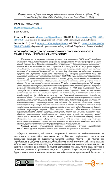
З’ясовано, що з існуючих світових практик, законодавство США та ЄС найбільш досконало регламентує питання охорони та використання ґрунтових ресурсів, а їхній досвід є цінним і для України, яка лиш формує законодавчу базу охорони та моніторингу ґрунтів. Основною метою National Cooperative Soil Survey (NCSS, США) є різностороннє дослідження, інвентаризація, картографування та інтерпретація ґрунтів для надання науково обґрунтованої інформації про ґрунти для сільського господарства, охорони природи та управління земельними ресурсами. ЄС створює законодавче поле для організації моніторингу, приймаючи директиву 2025/2360 «Про моніторинг та стійкість ґрунтів». Ґрунтові одиниці визначаються за типом ґрунту та на основі закартованого ґрунтового покриву і мають відображати мінливість показників моніторингу на рівні не більше 5% та оперативні граничні показники. Україна, як асоційований член ЄС, також матиме зобов’язання реалізовувати моніторинг ґрунтів за цими стандартами і потребує розробки нормативних підходів до його організації. У 2024 році постановою КМУ затверджено порядок проведення моніторингу земель і ґрунтів. Однак, базові підходи залишились незмінними – вивчаємо ґрунти і їх властивості, а охороняємо землі і їхню продуктивність, без будь якого акценту на збереженні різноманіття ґрунтів та ґрунтової біоти. Саме моніторинг ґрунтів має слугувати базисом широко розгалуженої системи моніторингу земель та формувати достовірне джерело інформації щодо їхнього ґрунтоощадливого загосподарювання та підходів до охорони. Означення пакету індикаторних параметрів повинно здійснюватися з огляду на потреби кожного типу моніторингу з урахуванням морфологічних, морфометричних, водно-фізичних та фізико-хімічних параметрів ґрунтів. Такі пакети можуть обмежуватись базовими характеристиками ґрунтів (експрес-моніторинг), проте ніяк не лише площами угідь. Дієвість використання морфометричних параметрів ґрунтів на першому етапі моніторингу доведено в межах дослідження сучасного ґрунтового покриву заплав Закарпатської низовини. Антропогенні зміни гідрологічних умов спровокували трансформацію основних грунтотвірних процесів та формування особливих різновидів ґрунтів, що було діагностовано морфометричними дослідженнями.
It was found that of the existing world practices, the legislation of the USA and the EU most perfectly regulates the issues of protection and use of soil resources, and their experience is valuable for Ukraine, which is only forming the legislative framework for soil protection and monitoring. The main goal of the National Cooperative Soil Survey (NCSS, USA) is a multifaceted study, inventory, mapping and interpretation of soils to provide scientifically sound information about soils for agriculture, nature conservation and land resources management, etc. The European Union is creating a legislative framework for monitoring by adopting Directive 2025/2360 on Soil Monitoring and Sustainability in 2025. Soil units are defined by soil type and mapped soil cover and should reflect a variability of monitoring indicators of no more than 5% and operational thresholds.Ukraine, as an associated member of the EU, will also have an obligation to implement soil monitoring according to EU standards and needs to develop regulatory approaches to its organization. In 2024, the Cabinet of Ministers of Ukraine approved the procedure for conducting land and soil monitoring. However, the basic approaches have remained unchanged – we study soils and their properties, and protect lands and their productivity, without any emphasis on preserving the diversity of soils and soil biota. Soil monitoring should serve as the basis for a widely branched land monitoring system and form a reliable source of information on their soil-saving management and protection approaches. The definition of a package of indicator parameters should be carried out taking into account the needs of each type of monitoring, taking into account morphological, morphometric, water-physical and physico-chemical parameters of soils. Such packages may be limited to basic soil characteristics (express monitoring), but not only to land areas. The effectiveness of using morphometric soil parameters at the first stage of monitoring has been proven within the framework of a study of the modern soil cover of the floodplains of the Transcarpathian Lowland. Anthropogenic changes in hydrological conditions have provoked the transformation of the main soil-forming processes and the formation of special types of soils.
 10.36885/nzdpm.2026.42.14
Ключові слова: дерново-буроземні (Cambic Umbrisols) ґрунти; площинна та лінійна форма рекреації; лучні екосистеми; НПП «Сколівські Бескиди»
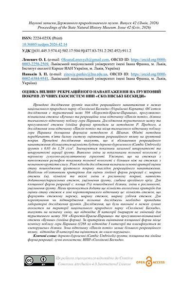
Проведено дослідження ґрунтів внаслідок рекреаційного навантаження в межах національного природного парку «Сколівські Бескиди» (Українські Карпати). Об’єктом дослідження є туристичний шлях 504 «Коростів-Красне-Парашка», прогулянково-пізнавальна стежка «Бучина» та рекреаційна зона відпочинку «Павлів потік», ділянка тимчасового відпочинку поблизу гори Парашки. Дослідження туристичного шляху та прогулянкової стежки (лінійна форма) проводили за методикою Р. Предкого, а дослідження зони відпочинку «Павлів потік» та місця тимчасового відпочинку поблизу гори Парашка (площинна форма)за методикою А. Шлапак. Обидві методики передбачають п’яти бальну систему оцінювання рекреаційного впливу на ґрунтовий покрив. Проведені дослідження вказують, що зі збільшенням рекреаційного навантаження збільшується щільність будови дерново-буроземного (Cambic Umbrisols) ґрунтів з 0,85 до 1,29 г/см3. Зменшуються показники загальної шпаруватості та шпаруватості аерації ґрунту. Виявлено зміни за показниками польової вологості у верхньому гумусово-акумулятивному горизонті. З’ясовано, що на стежках з виположеним рельєфом показники польової вологості є більшим ніж на стежках з незначною крутістю схилу. Різні підходи дослідження визначили основні критерії оцінки стану пошкодження ґрунтового покриву внаслідок рекреаційного навантаження. Найбільш об’єктивними критеріями для оцінки лінійної форми рекреації є: ширина стежки (м), кількісні та якісні зміни в рослинному покриві, наявність додаткових/паралельних стежок, ущільнення ґрунту, глибина ерозійного врізу. Для площинної форми рекреації є: площа (%) пошкодженої ділянки, зміни в рослинності, ущільнення ґрунту. Нами пропонується додати ще кількість екологічних критеріїв для оцінки стану стежок в зоні короткотривалого відпочинку це: кількість стежок, що формують стежкову мережу, ширину стежок, ширину узбіччя стежок. Для коректування чи підтвердження польових досліджень необхідно проводити лабораторні дослідження ґрунтів. Дослідження, що були виконані в межах лучних екосистем на території національного природного парку «Сколівські Бескиди», вказують на незначну зміну, що відповідає ІІ категорії (маршрут не змінений) для туристичного шляху 504 «Коростів-Красне-Парашка» та прогулянково-пізнавальної стежки «Бучина» (лінійна форма). За критеріями оцінювання площинної форми місце кемпінгу поблизу гори Парашка (1268 м) відповідає І категорії та класифікується як «непорушена» ділянка. Зона відпочинку «Павлів потік» зазнає більшого рекреаційного впливу, відповідає ІІ категорії та оцінюється, як «мало порушена».
TSoil studies were conducted to assess the impact of recreational pressure within the "Skole Beskydy" National Nature Park (Ukrainian Carpathians). The objects of the study included tourist route No. 504 "Korostiv-Krasne-Parashka," the "Buchyna" educational nature trail, the "Pavliv Potik" recreation area, and a temporary rest site near Mount Parashka. The investigation of the tourist route and the nature trail (linear forms) followed the methodology of R. Prędki, while the "Pavliv Potik" recreation zone and the temporary rest site near Mount Parashka (areal forms) were studied using A. Shlapak's methodology. Both methods employ a five-point scale to evaluate recreational impact on the soil cover.The findings indicate that increasing recreational pressure leads to a rise in the bulk density of Cambic Umbrisols soils from 0.85 to 1.29 g/cm³. Consequently, total porosity and aeration porosity decrease. Changes in field moisture content were observed within the upper humus-accumulative horizon. It was established that on trails situated on leveled (flattened) terrain, field moisture levels are higher than in the control plots.Various research approaches have identified the key criteria for assessing soil cover damage due to recreational activities. The most objective criteria for evaluating linear recreation forms include: trail width (m), quantitative and qualitative changes in vegetation cover, presence of secondary/parallel trails, soil compaction, and the depth of erosional incision. For areal recreation forms, the criteria include: the percentage of the damaged area (%), changes in vegetation, and soil compaction. We propose adding several ecological criteria for assessing trail conditions in short-term recreation zones, specifically: the number of paths forming the trail network, trail width, and the width of the trail shoulders. To calibrate or confirm field observations, supplementary laboratory soil analysis is essential.Studies conducted within meadow ecosystems of the "Skole Beskydy" National Nature Park indicate minor changes, corresponding to Category II (unaltered route) for tourist route No. 504 and the "Buchyna" trail (linear forms). According to the assessment criteria for areal forms, the camping site near Mount Parashka (1268 m) corresponds to Category I and is classified as an "undisturbed" site. The "Pavliv Potik" recreation zone experiences higher recreational pressure, corresponding to Category II, and is evaluated as "slightly disturbed."
 10.36885/nzdpm.2026.42.13
Ключові слова: оселище, раритетна рослинність, біорізноманіття, урбоекосистеми, надми, природно-заповідний фонд
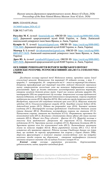
Досліджено оселища верхньої течії Збоївського потоку, проведено оцінку їхньої созологічної цінності. Встановлено для території 18 підтипів оселищ, з яких 3 – природні, 5 – напівприродні, 10 – антропогенні та 4 – зниклі на території досліджень. Історична трансформація цієї території внаслідок людської діяльності спричинила значну гетерогенність екологічних умов та визначила диференціацію оселищного різноманіття. Зараз це досить інтенсивно загосподарьована приміська територія, утворена мозаїкою біотопів різних типів. Серед них можна виділити природні (N), напівприродні (SN) та антропогенні (A) оселища. Антропогенні оселища представлені такими підтипами, як Сіяні травостої інтенсивного використання, зокрема спортивні майданчики та газони (E2.6), Вирубки (G5.8), Малі сади та городи (непромислові) (I1.2), Необроблені, перелогові або нещодавно покинуті орні землі (I1.5), Нещільна житлова забудова (J2.1), Сільськогосподарські споруди (J2.4), Занедбані сільські будівлі (J2.6), Автомобільні шляхи (J4.2), Хідники та рекреаційні зони (J4.6), Замощені частини кладовищ (J4.7). Квазіприродні оселища представлені: Стабільними дюнними луками (сірими дюнами) (B1.4), Постійними мезотрофними озерами та ставками (C1.2), Тимчасовими озерами, ставками та басейнами (C1.6.), Очеретяними заростями без вільностоячої води (D5.1), Болотами з домінуванням Juncus effusus або інших високих ситників (D5.3), Мішані ліси Pinus sylvestris – Quercus (G 4.7). Природні оселища в минулому були представлені: Джерелами та струмками (C2.1), Тимчасовими водотоками (C2.5), Заростями високих гелофітів (С3.2), Верховими болотами (D1.1), Заростями крупних осок без вільностоячої води (D5.2), Листопадними заплавними лісами на некислих торфах (G1.4). Низка раритетних оселищ (D1.1, C1.2, G1.4) остаточно або практично втрачені. Рідкісне оселище Стабільних дюнних лук (сірих дюн), що входить до переліку пріоритетних для охорони у Європі (Natura 2000), зберіглось фрагментарно в комплексі мішаних сосново-дубових лісів та потребує нагальних заходів охорони та збереження – створення ландшафтного (лісового) заказника місцевого значення «Ліс на надмах Голоско» площею 85 га.
The habitats of the headwater of the Zboyischcha Stream were studied and their sociological value was assessed. Eighteen habitat subtypes have been identified for the territory, of which 3 are natural, 5 are semi-natural, 10 are anthropogenic, and 4 are extinct in the study area. The historical transformation of this territory due to human activity has caused significant heterogeneity of ecological conditions and determined the differentiation of habitat diversity. Now it is an intensively managed suburban area, formed by a mosaic of biotopes of different types. Among them, natural (N), semi-natural (SN) and anthropogenic (A) habitats can be distinguished. Anthropogenic habitats are represented by the following subtypes: Agriculturally-improved, re-seeded and heavily fertilised grassland, including sports fields and grass lawns (E2.6), Recently felled areas (G5.8), Mixed crops of market gardens and horticulture (non-industrial) (I1.2), Bare tilled, fallow or recently abandoned arable land (I1.5), Scattered residential buildings (J2.1), Agricultural constructions (J2.4), Disused rural constructions (J2.6), Road networks (J4.2), Pavements and recreation areas (J4.6), Constructed parts of cemeteries (J4.7). Quasi-natural habitats are represented by: Coastal stable dune grassland (grey dunes) (B1.4), Permanent mesotrophic lakes, ponds and pools (C1.2), Temporary lakes, ponds and pools (C1.6.), Reedbeds normally without free-standing water (D5.1), Swamps and marshes dominated by Juncus effusus or other large Juncus spp. (D5.3), Mixed Pinus sylvestris-Quercus woodland (G 4.7). Natural habitats in the past were represented by: Springs, spring brooks and geysers (C2.1), Temporary running waters (C2.5), Water-fringing reedbeds and tall helophytes other than canes (C3.2), Raised bogs (D1.1), Beds of large sedges normally without free-standing water (D5.2), Broadleaved swamp woodland not on acid peat (G1.4). A number of rare habitats (D1.1, C1.2, G1.4) are completely or practically lost. The rare habitat of Grey dunes, which is belonging to network of Europe protected areas list (Natura 2000), has been preserved fragmentarily in a complex of mixed pine-oak forests and requires urgent protection and conservation measures - the creation of a landscape (forest) reserve of local importance "Forest on the Holosko dunes" (“Lis na nadmach Holosko”) with an area of 85 hectares.
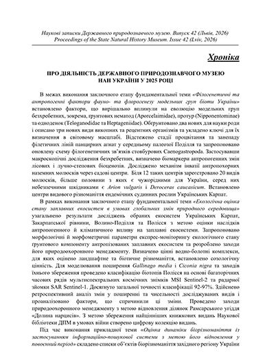
В межах виконання заключного етапу фундаментальної теми «Філогенетичні та антропогенні фактори фауно- та флорогенезу модельних груп біоти України» встановлено фактори, що вирішально вплинули на еволюцію модельних груп безхребетних, зокрема, ґрунтових нематод (Aporcelaimidae), протур (Nipponentominae) та одноденок (Teloganodidae та Heptageniidae). Обґрунтовано два нових для науки роди і описано три нових види викопних та рецентних організмів та укладено ключі для їх визначення в світовому масштабі. Відстежено стадії процвітання та занепаду філетичних ліній панцирних агнат у середньому палеозої Поділля та запропоновано оновлену схему філогенетичних зв’язків стовбурових Caenogastropoda. Застосувавши макроскопічні дослідження безхребетних, визначено біомаркери антропогенних змін лісових і лучно-степових біоценозів. Досліджено механізм інвазії антропохорних наземних молюсків через садові центри. Біля 12 таких центрів зареєстровано 20 видів молюсків, більше половини з яких є чужорідними для України, серед них небезпечними шкідниками є Arion vulgaris і Deroceras caucasicum. Встановлено центри видового різноманіття ендемічних судинних рослин Українських Карпат ...
У квітні 2026 року у Республіці Косово відбулась міжнародна тренінгова програма «Training on Digitisation and Preservation of Museum Collections: 2D and 3D», що була організована Косовським фондом «Культурна спадщина без кордонів» (Cultural Heritage without Borders Kosovo / CHwB Kosovo) у співпраці з HeMo (Лабораторія моніторингу української спадщини). Програма була спрямована на посилення професійних спроможностей музейних працівників Косова у сфері документування, оцифрування, управління та довгострокового збереження цифрових даних про музейні колекції.
Тренінг реалізовувався за підтримки Cultural Emergency Response (CER) з Нідерландів та Міністерства культури Косова. CHwB Kosovo є частиною Балканського хабу з реагування на надзвичайні ситуації у сфері культурної спадщини, що визначило ширший контекст програми: оцифрування розглядалося не лише як інструмент доступності й популяризації колекцій, а й як важлива складова захисту культурної спадщини в умовах криз, нестабільності та ризиків для музейних зібрань ...
У науковому фаховому виданні «Наукові записки Державного природознавчого музею» публікуються статті з екології, профільних наукових дисциплін природничих музеїв, а також матеріали про музейну діяльність.
До публікації приймаються статті підготовлені на матеріалах, отриманих в результаті наукового опрацювання музейних колекцій або зібраних під час польових досліджень, які відповідають науковим напрямам діяльності музею.
Статті приймаються українською та англійською мовами. Структура статей, як правило, повинна містити такі елементи: вступ (без заголовку), матеріал і методику досліджень, результати досліджень (та їхнє обговорення), висновки, використану література (без заголовку), резюме (українською та англійською мовами обсягом не менше 1800 знаків без пробілів) та ключові слова (6-8 слів або словосполучень) ...